The Bath River Line project aims to create a 10km linear park following the River Avon through the heart of Bath. The project has three phases and phase one will cover the stretch from Newbridge to Bath Quays.
Project aims
The Bath River Line has the following objectives:
- Enhance and expand the active travel network in Bath by creating a level, accessible route from Newbridge to Batheaston
- Improve biodiversity and climate change resilience by creating and enhancing natural habitats
- Provide a safe, social and inclusive space for residents and visitors
Phase One: Construction 2025 to 2026
Phase One of the Bath River Line is funded by the West of England Mayoral Combined Authority and the UK Social Prosperity Fund, funded by UK Government. It includes new seating, improved access to the river path and planting along the river path between Windsor Bridge and Green Park.
Please expand the sections below to find out more.
The park has had works done to improve access and leisure, including a newly resurfaced path, widened entrance, and a new river viewing and seating area.
In 2026 the play park will receive some TLC to make it a welcoming place to play as well as a new path to the play area and the river path, additional cycle racks and extra bin.
The path outside has been cleared and prepared with low-nutrient topsoil to support wildflower growth. Pollinator-friendly planting is scheduled for this autumn. A handrail and tactile paving have been added to the steps.
A handrail and tactile paving have been added to the steps.
Upcoming works: late 2025 to early 2026
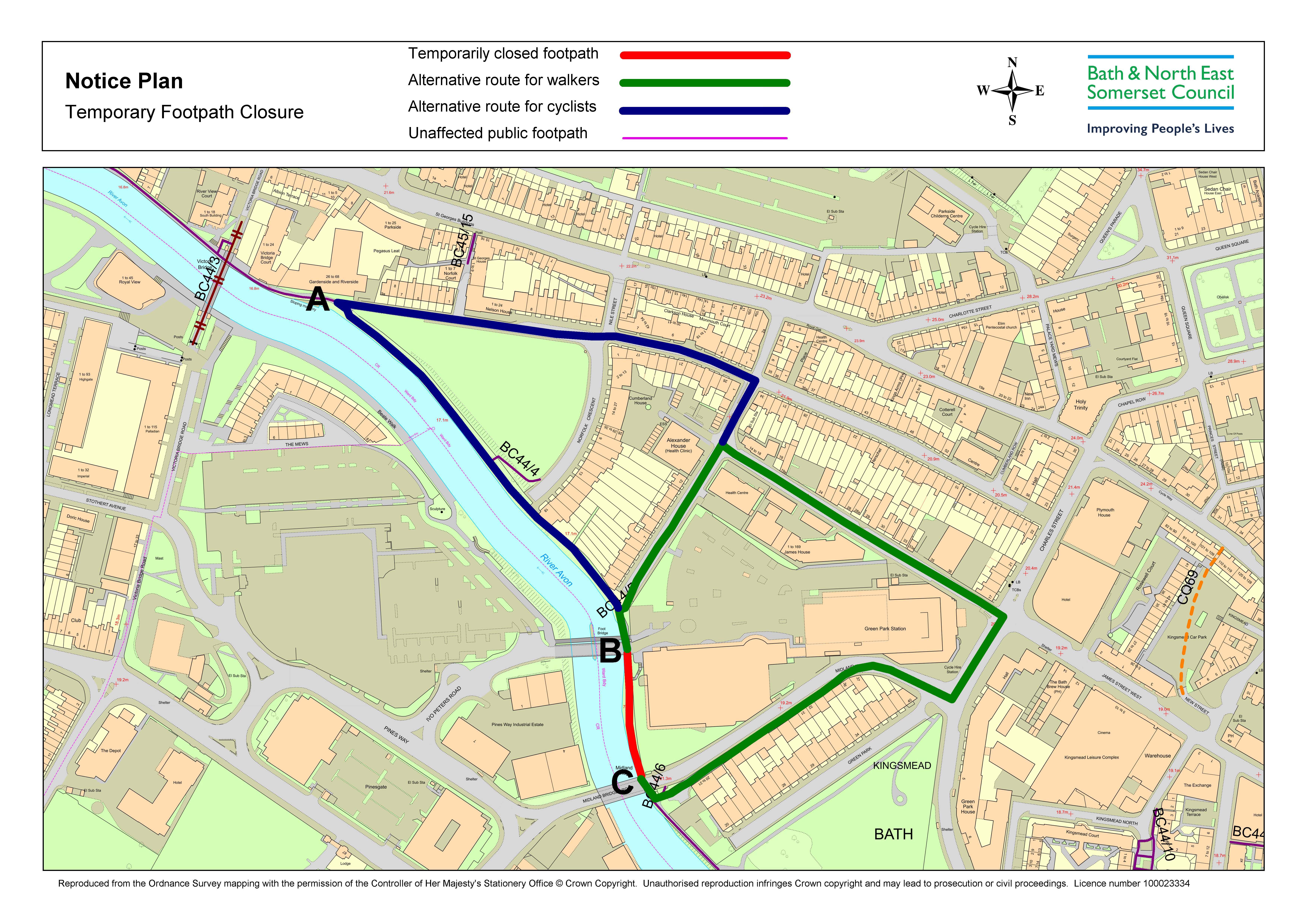
The river path between Green Park and Sainsburys (red line on map below) is currently due to be closed for works between 24 November and 15 December. Diversion signs will lead you along the green diversion route. Please follow advice of the contractors to keep everyone safe.
We will be providing:
- improved step access to the top of the crescent, with a paved landing area and new planting
- a seating nook outside BRAC café with cycle racks
We will be providing:
- a new accessible ramp and steps
- a new seating area with trees and pollinator planting
Vegetation at the seating area has been cleared in preparation for further improvements. In October 2025, we are adding a new seating area, bin, cycle racks and pollinator planting in the form of a rain garden.
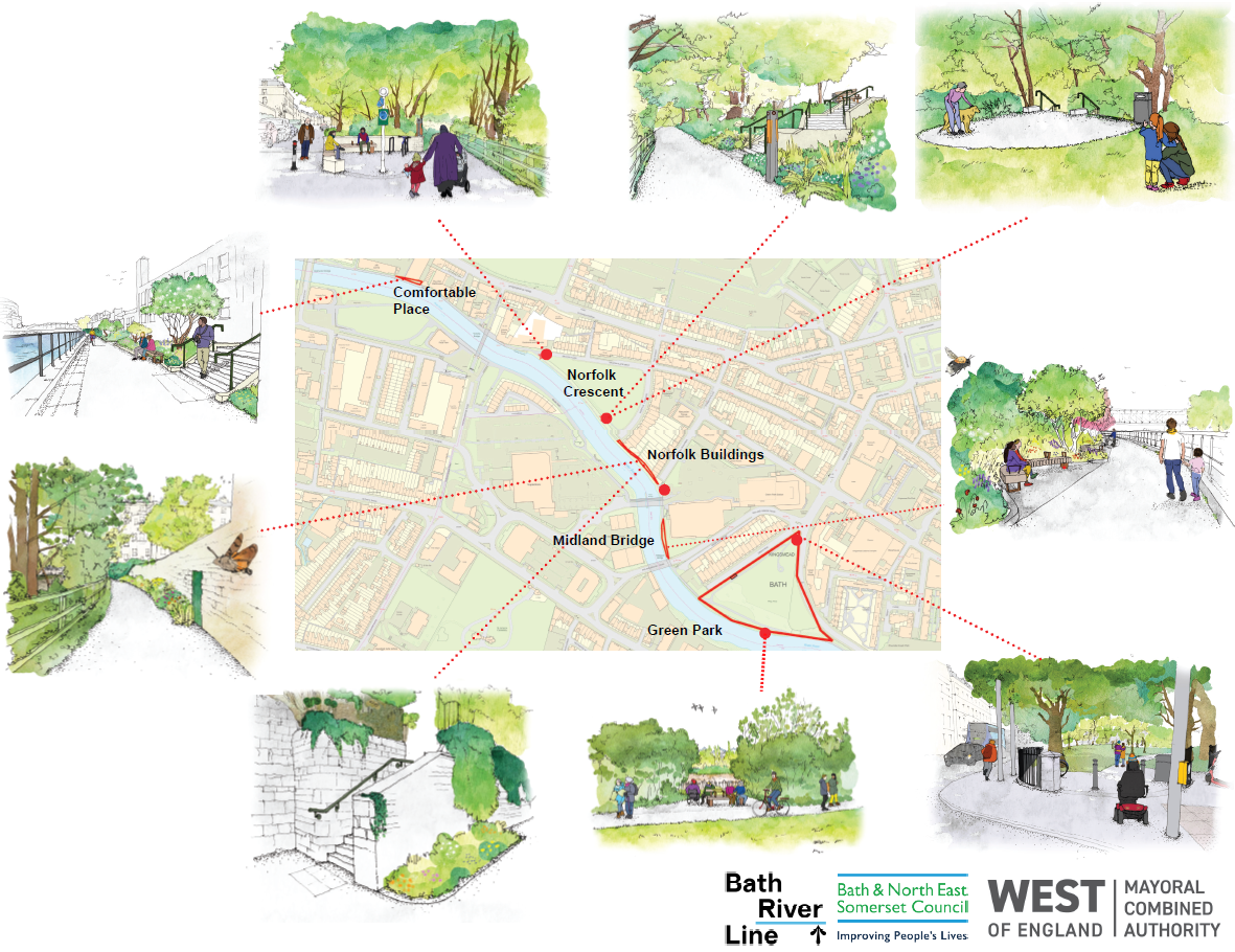
View maps and sketches of the improvements
Artist’s impressions of proposed changes along the towpath in Bath as part of the Bath River Line project.
The map below shows the Bath River Line and where improvements are being made:
Please email riveravon@bathnes.gov.uk if you have any feedback, queries or concerns during the construction phase. Out of hours emergencies can be reported via the Council Connect service on 01225 477477.
New Signage – Coming soon!
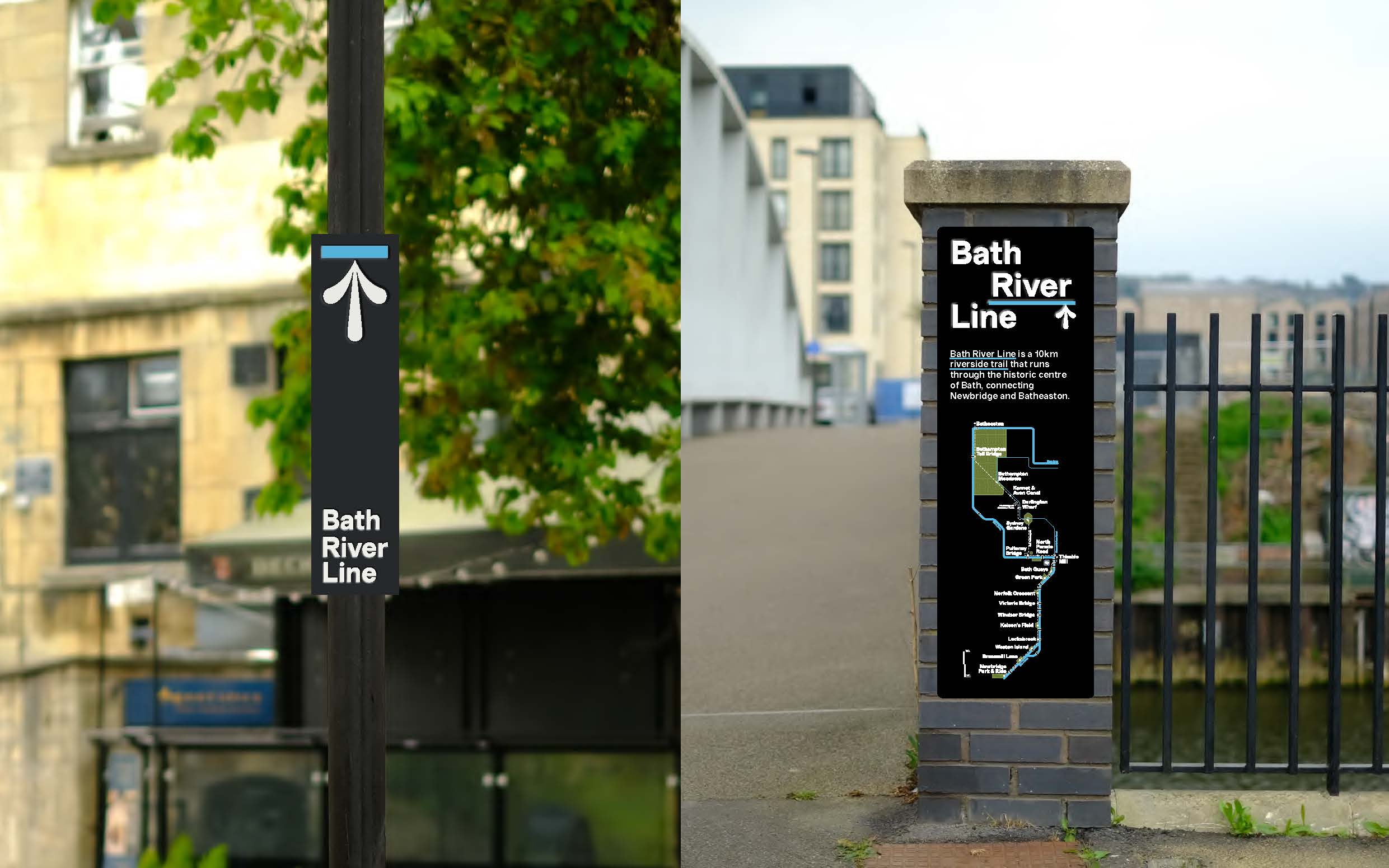
New signs are being added along the Bath River Line, designed by Fieldwork Facility and engineered and installed by Rivermeade. These include wayfinding signs and story panels to help people explore the route between Pulteney Bridge and Newbridge.
The designs were inspired from the flood marks under Halfpenny bridge. Installation is planned for November / December 2025.
Examples of upcoming Bath River Line signage to be installed along the riverside route, featuring a wayfinding post and trail map.
The Bath River Line team are running monthly walks, join one to learn more about the river’s ecology and history.
Details can be found on social media: Instagram @GreenBathNES and @BathNESCouncil, X: @WaterSpaceBath) or Eventbrite: WaterSpace Connected
You can also subscribe to our e-newsletter to stay in the loop.
The concept of a new 10km riverside path and improvements to the public realm for Bath first emerged from our WaterSpace Study.
Plans for the Bath River Line were developed following extensive community engagement and consultation in 2021.You can view the consultation report here.
The Bath River Line is an urban green and blue infrastructure project grant funded by the West of England Mayoral Combined Authority (WECA), developed in partnership with the Canal & River Trust, the Environment Agency, Wessex Water, National Trust and Bath Spa University.


