About this page
How this part of the Local Plan Options Document works
These potential site pages contain the following sections:
Policy background
- Relevant national policy or regulations
- National or regional trends
- Local situation and needs
- Relevant pieces of national or local policy, or evidence base document links
- How we have dealt with this issue in the past
- The thinking behind the policy
Site analysis
A short summary of our assessment of the site so far
- Opportunities presented by the site
- Constraints (obstacles which might make it a poor site to develop
- Mitigations (Measures that would be needed to reduce any harm development would cause)
- Further information we'd need to make a more in-depth assessment of the suitability of the site
Discussion questions
We'll ask one or more broad questions which may cover:
- the wording of the policy
- comparing the policy with other elements of council policy or strategy
- asking for suggestions for alternative approaches or ideas
Policy context note
Where decisions about this policy may affect how we approach other policies (or vice versa), we will add a note to explain
Explore this potential site
Select a section below to read more.
This is a potential site for development that we have no immediate plans for. We are presenting some outline information about the site, its location, available facilities and possible uses. We done some site analysis, and list the opportunities and constraints presented by the site, as well as identifying mitigation that would be needed to limit harm of development there, and further investigation we would need to do, to determine its suitability. We are including this potential site in the Local Plan Options Document with a discussion question that we would like your feedback on.
5.99 This location has been identified as a potential long-term opportunity for a standalone development or new community that could help to address objectively assessed needs either towards the end of the Local Plan period or beyond the plan period, as part of a longer-term spatial strategy. The council is seeking views on whether stakeholders consider it should be explored.
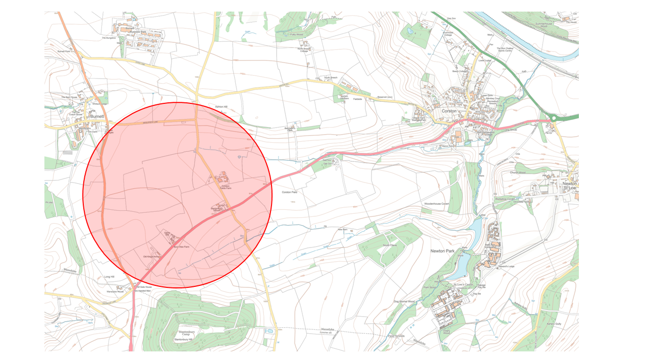
5.100 It is included in the Options document to assess the potential issues that would need to be considered and whether this area has any merit for further discussion and exploration. The map below indicates a broad area of search. The area is identified as causing less harm to the landscape than other locations close to Bath, although woodland planting would be required in the area to the west as screening to the Chew Valley.
Figure 15: Broad area of search south of Burnett
5.101 As it is some distance away from any reasonably sized communities, it would need to be of sufficient scale to provide day-to-day services such as a primary school and local shops. It would also be reliant on improvements to public transport and active travel routes, which if delivered, would also benefit other existing communities along this route and in the wider area. Considerable further work is required to identify whether these issues are achievable.
5.102 One of the potential benefits of this location is that a significant portion of this area is owned by the Duchy, who have a proven track record of delivering high quality, sustainable and mixed use development. An additional benefit of this location is that, given its proximity to the Bath Spa University campus, there could be opportunities to deliver some of their future needs in this location. This has not yet been discussed with Bath Spa University.
5.103 Views of stakeholders are sought as to whether this location should be explored as a potential, longer term development opportunity.
Opportunities
- The area provides a potential opportunity for a small new settlement/community and employment.
- It lies relatively close to Bath on the A39 bus corridor that could potentially be improved.
- It could contribute to the longer term growth strategy for B&NES.
Constraints
- Currently poor connectivity to the A4/Bristol-Bath strategic corridor as the main public transport corridor which is the current focus for investment.
- Stantonbury Hill and its setting - scheduled ancient monument.
- The area lies within the Green Belt.
- There are some existing hedgerows and plantations within the area which should be protected.
- A high-pressure gas pipeline cuts across the area.
- A 33kV overhead powerline cuts across part of the area.
- The area is separated from existing towns and facilities
Mitigation required
- Woodland screening to the west to mitigate impacts on the Chew Valley.
- An appropriate response to the setting of Stantonbury Hill.
Further investigation or evidence
- Heritage assessment of the potential impacts on Stantonbury Hill and its setting.
- This location may raise issues under HRA and SAC bat surveys may be required
Question 1
Do you think we should explore the potential for longer-term development in this location? Please explain your reasons.

