The route begins on High Street in Weston and goes along Weston Park before joining Weston Road. It then goes through Royal Victoria Park and down Royal Avenue to reach Queen Square. New sections of cycle lanes along quiet streets and segregated cycle tracks are among the proposals. Stakeholder feedback has indicated parking at Royal Victoria Park is not at full capacity.
The designs will be developed in more detail following the public consultation and further technical information being collected. The designs will be subject to further technical approval and funding requirements.
Expand the sections below to find out more about the improvements we are proposing.
We are proposing the following for Weston High Street:
- The mini roundabout at the junction of the High Street and Lansdown Lane would be altered to slow traffic down to improve walking, wheeling, and cycling links to the new routes.
- We have looked at options for improving the cycle route along High Street but traffic flows are high and space for segregated cycling is very limited. The options we have identified so far do not meet the high quality we are aiming for. We intend to continue investigating what the best solution for cycling on this section.
- The centre line would be removed which has been shown to reduce traffic speeds.
- Heading south east towards the city centre the cycling route would continue to travel along with the one-way traffic. Away from the city centre people cycling would continue to use the advisory cycle lane on Crown Road.
- The existing zebra crossing on Crown Road would be converted to a parallel crossing (a dual-purpose crossing where walking and cycling is separated).
We are proposing the following for Weston High Street:
- On Crown Hill and Weston Park the cycle route would follow a quietway.
- Existing on-street car parking would be formalised by defining the parking bays. This forms a traffic calming measure by narrowing the road.
We are proposing the following for Weston Road:
- New cycle lanes would be created on both sides of Weston Road, taking the form of white painted lines. These are known as advisory cycle lanes. The centre line would be removed which has been shown to reduce traffic speeds.
- The mini roundabout at the junction of Weston Road and Park Lane would be altered to give more space for walking, wheeling, and cycling, and to slow traffic down to make it safer.
We are proposing the following for Royal Victoria Park:
- The access road into Royal Victoria Park at Park Lane would be closed to motor vehicles to stop people using the road as a shortcut and reduce overall traffic in the park. People would need to access the park via Weston Road or Marlborough Lane by car. Car parking in this section of the park would also need to be removed. This would make the route safer for people walking, wheeling and cycling.
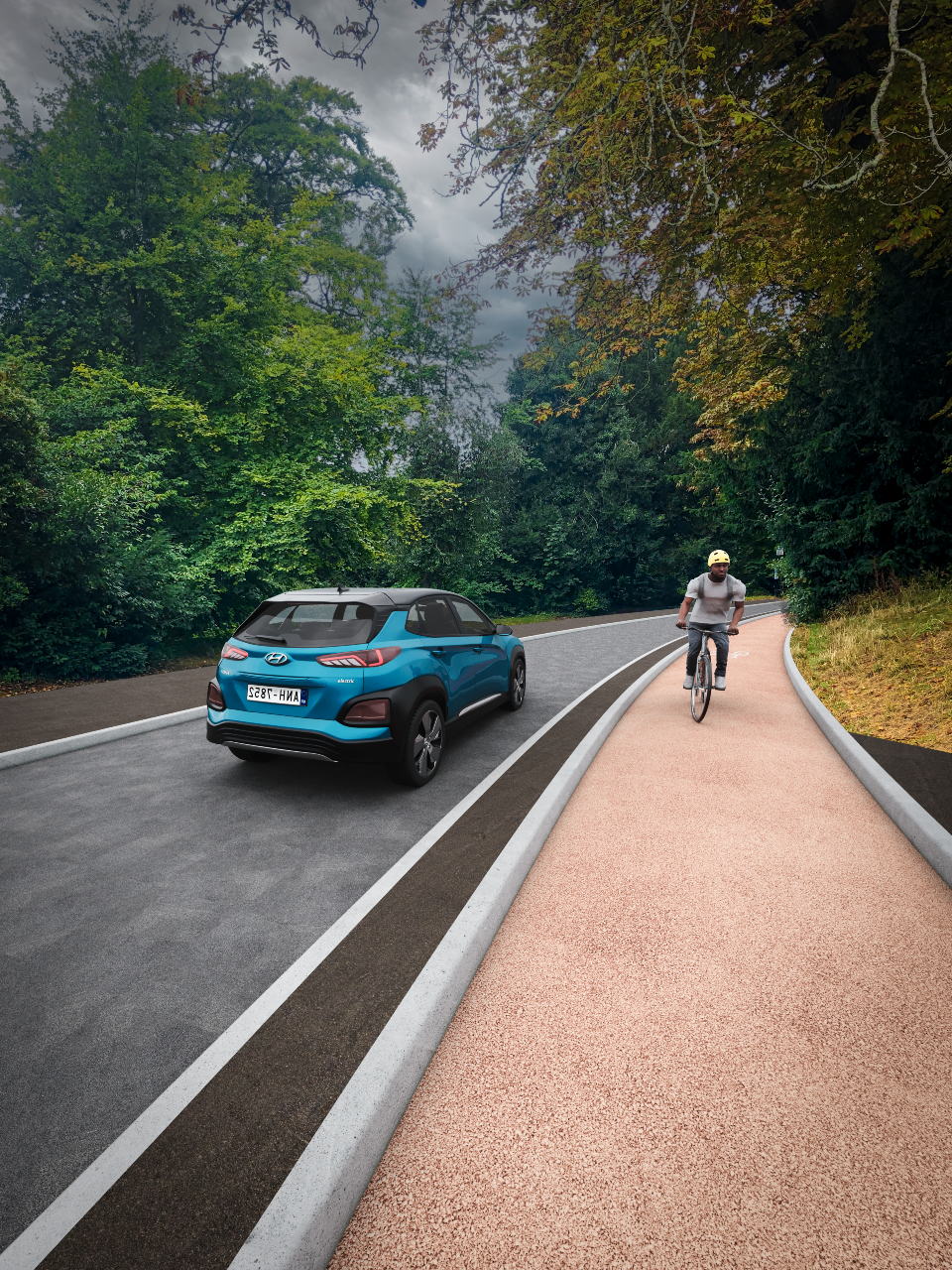
- Using the Park Lane access road, heading south-east towards the city centre the cycle route would join a segregated cycle track as this would be against the flow of traffic; this arrangement is known as a contra-flow.
An artist's impression of a segregated contra-flow cycle track, based on our preliminary designs
- Travelling in a northwest direction would share the road with the one-way motor traffic.
- There would be some loss of car parking along the access road from Park Lane and along the southern park circuit. This could be up to 82 spaces and the disabled parking bays will be retained.
We are proposing the following for Royal Victoria Park to Queen Square:
From the Victoria Obelisk the cycle route would cross Marlborough Lane and follow Royal Avenue and the quietway on Queen’s Parade – improvements to street lighting are the only proposed change here.
We are proposing the following for Queen Square:
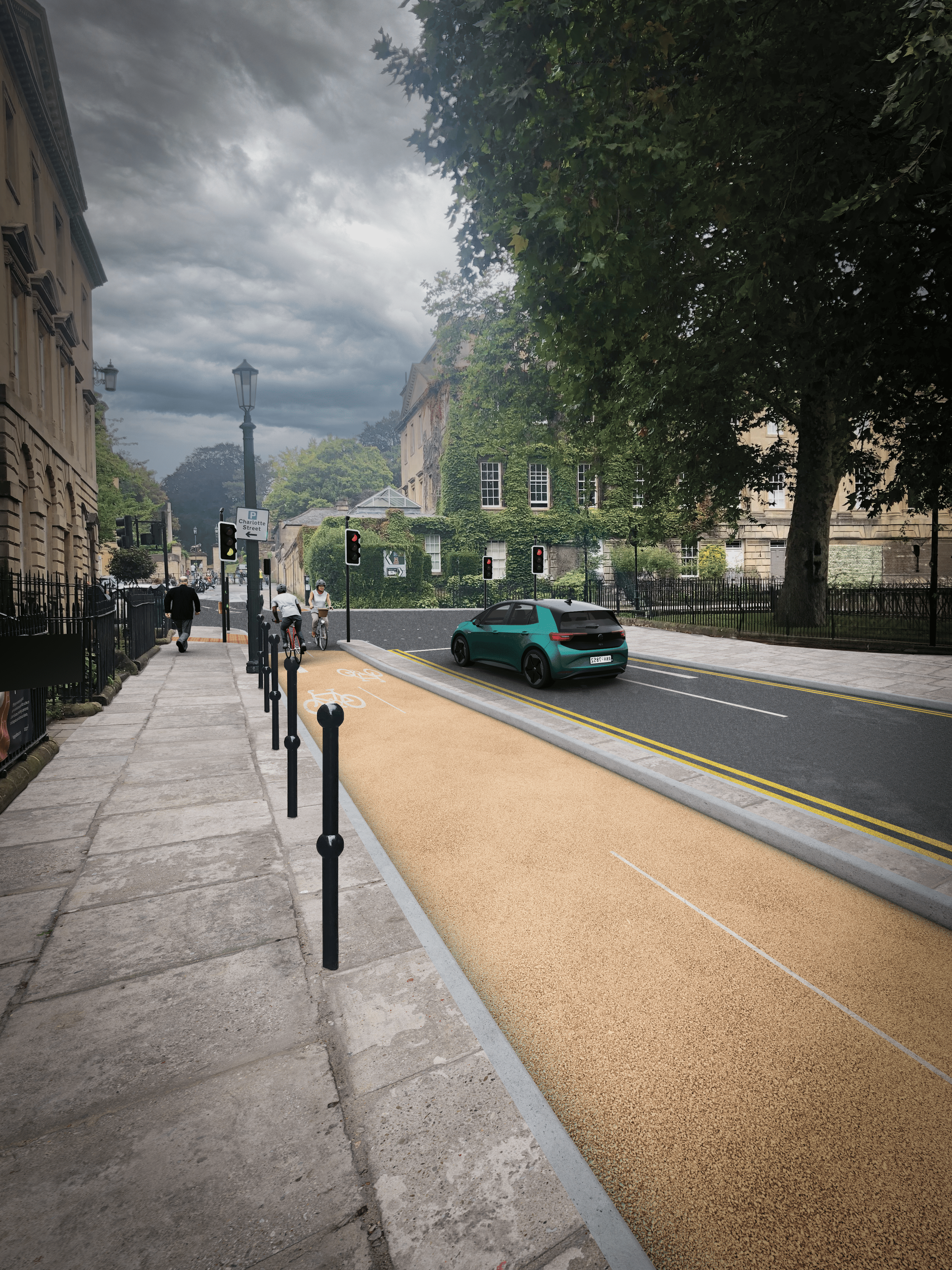
- A new two-way segregated cycle track north to south from Queen’s Parade to Princes Street/Chapel Row (on the west side of the square).
An artist's impression of a segregated cycle track, based on our preliminary designs
- This route would include new cycling signal sat the north and south ends of the cycle track.
- The existing narrow pavement next to the Queen Square park would be made wider to make it safer for those walking and wheeling but this would mean the loss of approximately 8 car parking spaces.
- The junction at the southwest corner would be modified to create a safe cycling route from Chapel Row and exit the track into Princes Street.
- From Queen Square, the route continues south via Princes Street towards Beaufort Square where it will intersect with the National Cycle Route 4. Travelling north, the cycle route would be signposted via Monmouth Street and Chapel Row.
Who we are consulting with
We want to hear from anyone who has an interest in this area, whether you travel by walking, wheeling, or cycling or not. We want to understand if these proposals will enable people to adopt active travel methods, and whether there are any measures or infrastructure that you think we have missed.
Respond to the consultation online
The consultation is now closed.
Get an alternative format
If you need the consultation material in an alternative format such as large print, easy read, audio recording, or braille please email strategic_transport@bathnes.gov.uk
Come to a consultation event
We will be holding four consultation events where we will be able to answer any questions you may have about our proposals. The table below shows the details of the events.
| Date and time | Location |
|---|---|
| Monday 4 November 2024, 3pm to 7pm | Locksbrook Campus, The Street, Bath Spa University, BA1 3EL |
| Monday 11 November 2024, 2pm to 5pm | Sydney Gardens Pavillion, Bath, BA2 4DB |
| Tuesday 12 November 2024, 3pm to 7pm | Brunswick Room, Guildhall, Bath, BA1 5AW |
| Wednesday 13 November 2024, 3pm to 7pm | Brunswick Room, Guildhall, Bath, BA1 5AW |
Keep informed
Subscribe to our newsletter. If you would like to receive this newsletter in another format please contact us using the details above.


