Our proposals will mean that bus stops are redesigned along the Upper Bristol Road, between junctions with Midland Road and Charlotte Street.
Changes since the previous consultation
Select a topic below, to read in more detail about the proposed changes.
Our original bus stop proposals have been amended so we can include several 30-minute parking bays to allow for servicing and deliveries in the road. The proposals now include two types of bus stop designs:
Floating bus stops
At a floating bus stop, the cycle lane continues up a ramp to the same level of the pavement at the bus stop and then goes back down to road level once it has passed the stop. This enables cyclists to pass a stationary bus without having to come out of the cycle lane and into moving traffic.
There is an island which people would step onto for getting on or off the bus. A zebra crossing is marked on the cycle lane for crossing between the island and the pavement.
The image below is similar to our proposal for Upper Bristol Road. As we have less space available, our islands would be slightly narrower which means the shelter would be on the pavement. We will also use red colour surfacing on the cycle lane where it passes through the bus stop.
Example of a floating bus stop (Copyright: Google)
Bus stop boarders
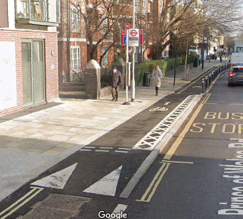
With bus stop boarders, the cycle lane continues up a ramp to the same level as the pavement in front of the bus stop.
Unlike the floating bus stop design, it is not possible to provide a zebra crossing in the cycle lane. There will be signs, textured paving and road markings to make sure cyclists know they need to give way to bus users on this shared piece of pavement. There would also be ‘tactile paving’ between the edge of the pavement and the cycle lane to aid bus users with reduced visibility.
The image below shows a similar design, although our proposal also includes a red coloured cycle lane where it passes at the same level as the pavement, and additional signs and road markings to tell cyclists to give way to pedestrians.
An example of a bus stop boarder (Copyright: Google)
We have made some changes to the proposed locations of bus stops and shelters to accommodate the cycle lane designs. Please refer to the drawings to see the exact location of each stop. The following stops are in front of businesses or residential properties:
- 14a Monmouth Place
- The bus shelter would be re-positioned from its existing location in front of Monmouth Court (14 Monmouth Place). It would use the bus stop boarder design.
- Lamp Post Villa
- The bus shelter would be re-positioned from its existing location in front of Bridgnorth House. It would use the bus stop boarder design.
- North Building, River View Court
- The bus stop would be relocated from its existing location, in front of Ivy Lodge. A new bus shelter would be provided. It would use the floating bus stop design.
- Opposite 7 to 9 Comfortable Place (Phase One Gym)
- The bus stop would be relocated from the current location opposite Ivy Lodge, to opposite Phase One Gym. A new bus shelter would be provided. It would use the floating bus stop design.

