The scheme should change the character of Upper Bristol Road. Our proposed changes aim to create a cleaner and quieter local neighbourhood.
As part of the proposals, we plan to plant three new trees within the pavement area.
Select a topic below to read in more detail about the changes we are proposing.
We aim to encourage more people to travel by bike, resulting in less congestion and better air quality in your neighbourhood. Motor traffic will be travelling at a slower speed, improving the safety of the road, and reducing road noise. The provision of cycle lanes will also mean that along much of the road, motor vehicles would not be travelling as close to properties as they do now.
View a map of the area covered by the proposed 20mph speed limit
Parking bays in Upper Bristol Road
The most frequently expressed concern at the last consultation related to the loss of car parking bays. Although the proposals include replacement parking spaces in other nearby streets, there is still a need for deliveries and servicing requirements to homes and businesses in Upper Bristol Road.
We have therefore amended our proposals to include some short sections of car parking. Where possible, these will be 'floating' bays where the cycle lane passes on the inside of the parking bay, as this is safer for cyclists when passing parked vehicles.
These would all offer time-limited 30-minute stays between set hours (detailed below), to help make parking regularly available during the daytime, with unlimited stays outside of those hours.
Changes at the Charlotte Street end of the road:
- A new Parallel Zebra crossing for pedestrians and cyclists (see more information below)
- On the north side of the road, a floating bay with 4 spaces to the east of this crossing (30-minute maximum stay, 8am to 6pm), and a floating bay with 6 spaces to the west (4 30-minute maximum stay, 8am to 6pm, and 2 30-minute maximum stay, 8am to 11pm)
Parking for Blue Badge holders
Under the proposals, vehicles displaying a valid Blue Badge would be exempt from the 30-minute time limit which will apply to all of the new parking bays on Upper Bristol Road for some part of the day.
Other changes to parking in Zone 6
To help offset the loss of the 40 parking spaces in Upper Bristol Road, the original proposals stated we would make the following changes to parking within the Zone:
- Creating 19 additional spaces by removing single and double yellow lines
- Converting 14 shared use bays in Marlborough Lane to residents-only spaces
- Converting 12 Pay and Display bays in Royal Avenue to residents-only spaces
- Bringing forward proposals to change how hotel, guest house and holiday let permits operate. This will remove competition for on-street residents-only spaces by moving these users into Charlotte Street Car Park. There are currently 41 of these permits in Zone 6
Following feedback from our previous consultation, we have made the following changes to our proposals:
- Creating 18 additional spaces within Zone 6 by removing single and double yellow lines (one less space than before in Nile Street, due to changes to the junction design)
- Creating 8 spaces in Upper Bristol Road for time-limited parking (up to 30 minutes, 8am to 6pm), and 2 spaces (up to 30 minutes, 8am to 11pm). Although we cannot provide parking for specific businesses, the extended time-limited parking should make it easier for customers to find parking at a safe location
- Creating 20 additional Zone 6 spaces in Midland Road, where parking is currently restricted, but is usually fully occupied during the daytime
- Moving hotel, guest house and holiday let permits from Zone 6 streets into Charlotte Street Car Park. We have invited feedback about these proposals separately, as part of our Parking Permits consultation. That consultation recently closed, and we will confirm the decision on this shortly. There are currently 41 of these permits, which can currently park in Zone 6 streets. We would remove these under the proposal, freeing up space for residents
We are still proposing to convert the 14 shared use bays in Marlborough Lane and the 12 Pay and Display bays in Royal Avenue to residents-only spaces.
View the parking proposals for Upper Bristol Road
View the parking proposals for side roads in Zone 6
Changes to parking in Park Lane (Zone 12)
Parking on the east side of Park Lane, north of its junction with Tennyson Road, is currently unrestricted and is usually full all day. We are proposing to create parking bays that could accommodate 16 vehicles, with a 3-hour time restriction (8am to 6pm, Monday to Saturday), or unlimited stays for Zone 12 permit holders.
This would help create a greater turnaround of parking bays in Park Lane and also provide more space in Zone 12 where parking demand is high. It is not possible to provide bays for use by both Zone 6 and Zone 12 permit holders. However, under the proposals, anyone without a Zone 12 permit could park their vehicle there from 3pm on one day and not have to move it until 11am the following day.
Loading restriction in Upper Bristol Road
Introducing the new cycle lanes will reduce the width of Upper Bristol Road. As a result, allowing deliveries throughout the day would cause obstructions and delays for other traffic. To keep motor traffic flowing at the busiest times of the day, we are proposing to introduce a loading ban between 8am and 9am, and 4.30pm and 6pm, Monday to Friday. Vehicles will only be able to stop to load or unload during these times at the parking bays and the new layby outside the development at the former Hinton Garage.
View illustrated explanations of parking and loading restrictions and road markings
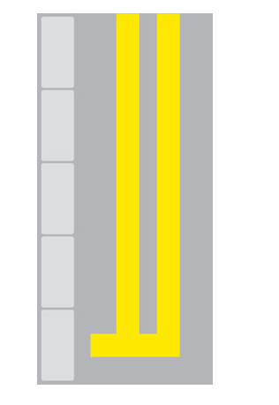
Double yellow lines prohibit parking at all times, referred to as ‘waiting’ in Traffic Regulation Orders. Stopping on or next to double yellow lines for the purposes of loading, unloading, picking someone up or dropping them off is permitted at all times, unless there is an additional loading restriction in force.
An example of double yellow line road markings
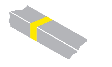
Loading restrictions are shown by a yellow ‘tick’ marking on the kerb and accompanying signs on the roadside. A single yellow tick means loading is prohibited at certain times of the day, and drivers should refer to the signs for those times. A double yellow tick marking means loading is prohibited at all times (our proposals do not include any ban of loading at all times). When a loading ban is in force, vehicles are not allowed to stop to load or unload. However, stopping to enable a passenger to get into or out of a vehicle is still permitted.
An example of loading restrictions road markings
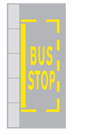
At bus stops where there is the yellow bus stop ‘cage’ marking on the road and a thick yellow line next to the kerb, stopping is not permitted except for buses and taxis. This means all other vehicles are not permitted to stop there at any time, not even for loading or picking up and dropping off passengers. This restriction already applies to bus stops in Bath.
An example of bus stop road markings
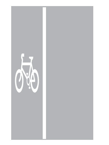
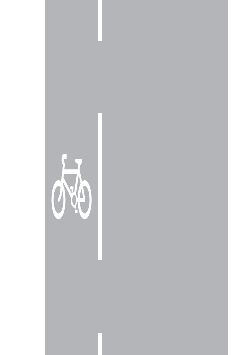
A cycle lane with a continuous white line is known as a mandatory cycle lane. Motor vehicles are not permitted to enter a mandatory cycle lane, except in an emergency. This means stopping in a cycle lane for loading or dropping off and picking up passengers is not permitted, regardless of whether there is a yellow line restriction within the cycle lane. We would provide an additional exemption to allow window or gutter cleaning vehicles when using a hose attachment to enter the cycle lane because of the need for properties to be serviced and since the occasions when they will need to do this will be infrequent.
An example of cycle lane road markings
Where cycle lanes pass a junction or access road, it changes to a dashed white line, which means motor vehicles may cross it for the purpose of entering or exiting that access or side road. We would provide a red colour within the cycle lane in our scheme to make the presence of the cycle lane clearer to drivers. The government recently announced forthcoming changes to the Highway Code which will state that drivers turning across a cycle lane to enter a side-road must give way to cyclists who are travelling straight ahead.
An example of cycle lane road markings at a junction or access road
Stopping next to the cycle lane for the purposes of loading, picking up and dropping off passengers is permitted (although loading is not permitted when a signed loading restriction is in force).
Layby outside the former Hinton Garage
We are proposing a new layby here, to cater for deliveries to this development, and minibuses or ambulances collecting or dropping off passengers. It would include double yellow line restrictions which allow loading and unloading.
Loading bay outside The Hop Pole public house
The proposed design provides a cycle lane through the loading bay outside The Hop Pole public house, stepped approximately 50mm above road-level. It enables cyclists to continue on the carriageway most of the time, when there is no vehicle in the loading bay. When the loading bay is in use, cyclists will be able to join a short section of shared-use pavement, to bypass the loading bay without being obstructed.
The loading bay would be time-limited to 30-minute stays, to enable deliveries to the pub or nearby properties, and dropping off or picking up passengers. It is necessary to provide the loading bay in this way because if it were on the outside of the cycle lane it would be difficult for vehicles to see past it to overtake due to the bend in the road.
The existing Pelican crossing at the Nile Street junction needs replacing as it has reached the end of its serviceable life. We are proposing a new Parallel Zebra crossing, relocated to the east of the junction. This will enable us to provide car parking at the widest point of Upper Bristol Road.
Parallel Zebra crossings are for pedestrians and cyclists, and this new one will provide an improved link to and from Nile Street.
Example of a Parallel Zebra Crossing (Copyright: Google)
We have made some changes to the proposed locations and designs of bus stops and shelters to accommodate the cycle lane designs. You can find out more about the new bus stop designs on our bus users page.
Please refer to the drawings to see the exact location of each stop. The following stops are in front of businesses or residential properties:
- 14a Monmouth Place
- The bus shelter would be re-positioned from its existing location in front of Monmouth Court (14 Monmouth Place). It would use the bus stop boarder design.
- Lamp Post Villa
- The bus shelter would be re-positioned from its existing location in front of Bridgnorth House. It would use the bus stop boarder design.
- North Building, River View Court
- The bus stop would be relocated from its existing location, in front of Ivy Lodge. A new bus shelter would be provided. It would use the floating bus stop design.
- Opposite 7 to 9 Comfortable Place (Phase One Gym)
- The bus stop would be relocated from the current location opposite Ivy Lodge, to opposite Phase One Gym. A new bus shelter would be provided. It would use the floating bus stop design.

