About this page
How this part of the Local Plan Options Document works
These site allocation pages contain the following sections:
Site background
- A broad description of the site, with map if appropriate
- An overview of development proposed or already in progress
- Relevant aspects of planning policy for this site
- The history and status of any planning applications for this site
Options for the new Local Plan
We may suggest one or more possible approaches:
- Keeping existing plans for this site as they are
- Making small changes to our approach, which may allow for changes
- Replacing the approach with something that is substantially different
- Identifying factors or events which may affect this policy in the future
Site analysis
A short summary of our assessment of the site so far
- Opportunities presented by the site
- Constraints (obstacles which might make it a poor site to develop
- Mitigations (Measures that would be needed to reduce any harm development would cause)
- Further information we'd need to make a more in-depth assessment of the suitability of the site
Policy context note
- Where decisions about this site may affect how we approach other sites (or vice versa), we will add a note to explain
Explore this site allocation
Select a section below to read more.
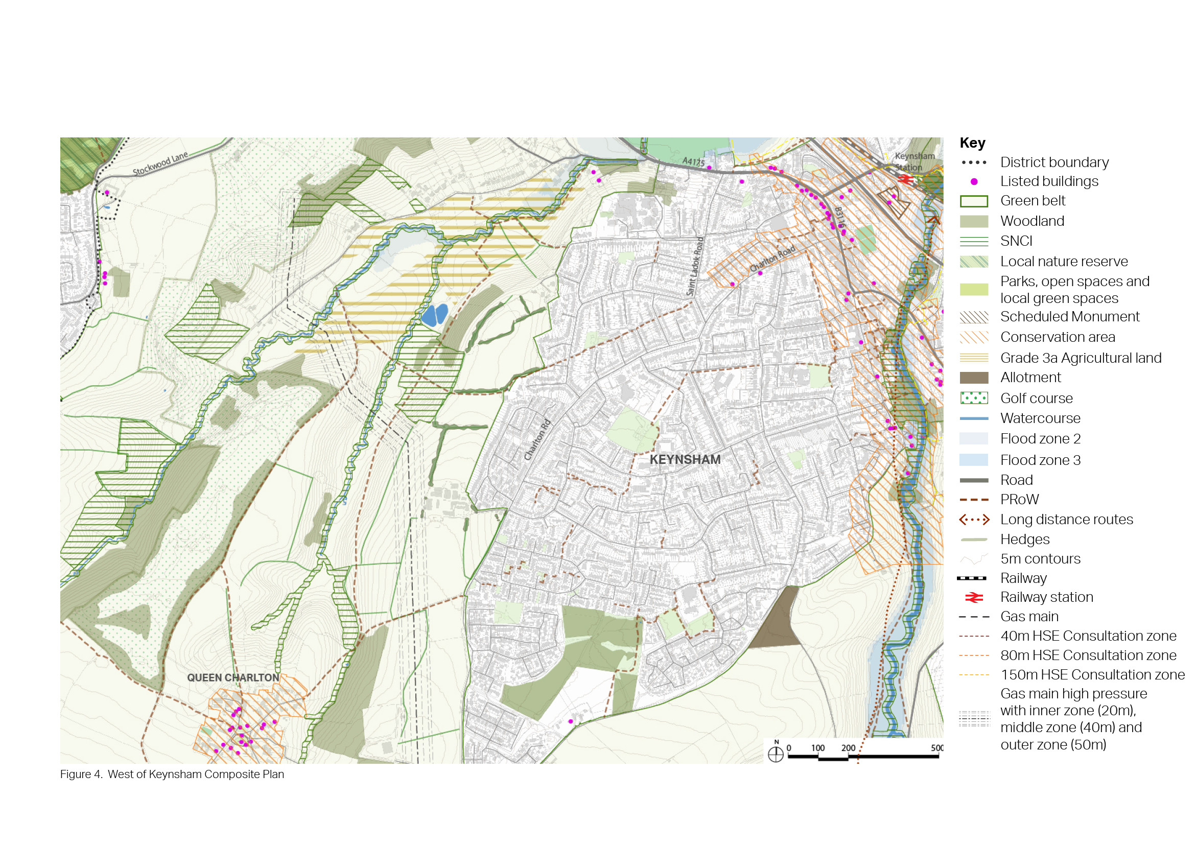
6.52 West Keynsham is located to the west of Charlton Road. The southern end of the site directly fronts Charlton Road, whereas the northern side neighbours the back gardens of the houses on Lays Drive.
6.53 The land is mainly used as arable fields with Lays Farm Trading Estate located in the centre. The site is fragmented by well-maintained hedgerows and mature trees creating enclosed areas. To the west of the site, the land slopes steeply towards Stockwood Vale.
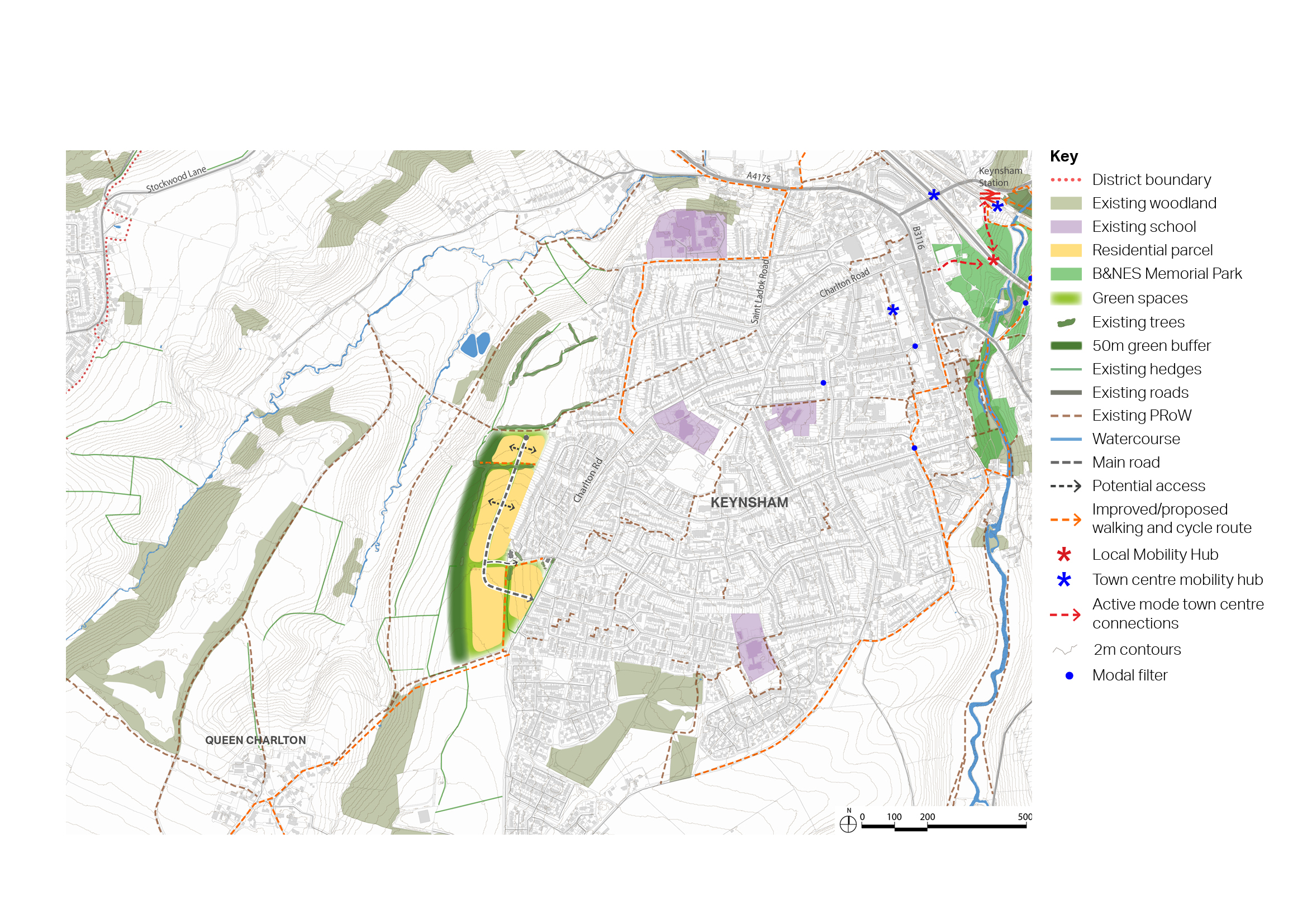
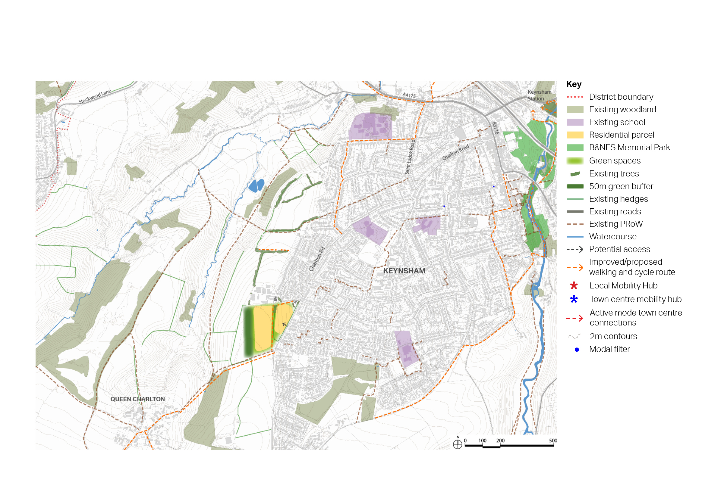
6.54 Two options for West Keynsham are set out below. The first optimises housing development in this area, but would require the relocation of businesses at Lays Farm Trading Estate. The second reduces the number of homes proposed significantly, retaining Lays Farm Trading Estate in situ.
6.55 The site is located in the Green Belt. The Strategic Green Belt Assessment carried out by WECA to inform the now halted Spatial Development Strategy assesses this land parcel (P82) as having the following contribution to each of the NPPF Green Belt purposes:
- Purpose 1 - checking the unrestricted sprawl of large built-up areas: Significant contribution
- Purpose 2 - preventing the merger of neighbouring towns: Significant contribution
- Purpose 3 – safeguarding the countryside from encroachment: Significant contribution
- Purpose 4 - preserving the setting and special character of historic towns: Moderate contribution
Figure 24: Context plan - West Keynsham
Opportunities
- Provision of 300 homes
Constraints
- Located in the Green Belt.
- Loss of employment land at Lays Farm Industrial Estate.
- Loss of agricultural land.
- Single vehicular access only from Charlton Road.
- Pedestrian access to the north of the site linking to town centre currently very narrow – improved assess required.
- Site lies within area designated as part of the Landscape Setting of Settlement, therefore development must consider conservation and enhancement of landscape character and landscape setting of Keynsham.
- Much of site covered by SNCI buffer.
Mitigation required
- 50m minimum GI buffer along western edge of site to mitigate harm to views from west.
- Tree-lined streets, and tree-line avenue to run north to south at highest point to enhance screening.
- SNCI to be retained and protected.
Further investigation or evidence
- Green Belt assessment required to assess impact of removing land from Green Belt, including cumulative impact when considering strategic removal across the district, and considering opportunities for enhancements to retained Green Belt land.
- Landscape assessment required to consider impact of development on Landscape Setting of Settlement.
- Consideration of potential risk to watercourse due to elevated position of site.
Opportunities
- Provision of 100 homes.
Constraints
- Located in the Green Belt.
- Site lies within area designated as Landscape Setting of Settlement, therefore development must consider conservation and enhancement of landscape character and landscape setting of Keynsham.
- Limited access to green space and local food growing provision. Green space would need to be accommodated on site.
50m GI buffer along western edge of site to mitigate harm to views from west.
- None identified.
Further investigation or evidence
- Green Belt assessment required to assess impact of removing land from Green Belt, including cumulative impact when considering strategic removal across the district and considering opportunities for enhancements to retained Green Belt land.
- Landscape assessment required to consider impact of development on Landscape Setting of Settlement.
- Consideration of potential risk to watercourse due to elevated position of site.


